


SWOYERSVILLE WD 01, Luzerne County, Pennsylvania
About
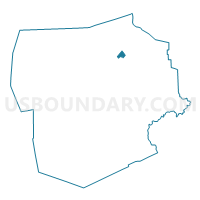
Outline

Summary
| Unique Area Identifier | 660877 |
| Name | SWOYERSVILLE WD 01 |
| County | Luzerne County |
| State | Pennsylvania |
| Area (square miles) | 1.24 |
| Land Area (square miles) | 1.24 |
| Water Area (square miles) | 0.00 |
| % of Land Area | 100.00 |
| % of Water Area | 0.00 |
| Latitude of the Internal Point | 41.30236620 |
| Longtitude of the Internal Point | -75.87680960 |
Maps


Graphs
Select a template below for downloading or customizing gragh for SWOYERSVILLE WD 01, Luzerne County, Pennsylvania


Neighbors
Neighoring Voting District (by Name) Neighboring Voting District on the Map
- FORTY FORT WD 03, Luzerne County, PA
- KINGSTON TWP WD 03, Luzerne County, PA
- SWOYERSVILLE WD 02, Luzerne County, PA
- SWOYERSVILLE WD 03, Luzerne County, PA
- WEST WYOMING DIST 01, Luzerne County, PA
- WYOMING WD 03, Luzerne County, PA
Top 10 Neighboring County Subdivision (by Population) Neighboring County Subdivision on the Map
- Kingston township, Luzerne County, PA (6,999)
- Swoyersville borough, Luzerne County, PA (5,062)
- Forty Fort borough, Luzerne County, PA (4,214)
- Wyoming borough, Luzerne County, PA (3,073)
- West Wyoming borough, Luzerne County, PA (2,725)
Top 10 Neighboring Place (by Population) Neighboring Place on the Map
- Swoyersville borough, PA (5,062)
- Forty Fort borough, PA (4,214)
- Wyoming borough, PA (3,073)
- West Wyoming borough, PA (2,725)
Top 10 Neighboring Unified School District (by Population) Neighboring Unified School District on the Map
- Wyoming Valley West School District, PA (42,261)
- Dallas School District, PA (20,566)
- Wyoming Area School District, PA (19,386)
Top 10 Neighboring State Legislative District Lower Chamber (by Population) Neighboring State Legislative District Lower Chamber on the Map
Top 10 Neighboring State Legislative District Upper Chamber (by Population) Neighboring State Legislative District Upper Chamber on the Map
Top 10 Neighboring 111th Congressional District (by Population) Neighboring 111th Congressional District on the Map
Top 10 Neighboring Census Tract (by Population) Neighboring Census Tract on the Map
- Census Tract 2114, Luzerne County, PA (6,999)
- Census Tract 2122, Luzerne County, PA (5,062)
- Census Tract 2121, Luzerne County, PA (4,214)
- Census Tract 2116, Luzerne County, PA (3,073)
- Census Tract 2115, Luzerne County, PA (2,725)